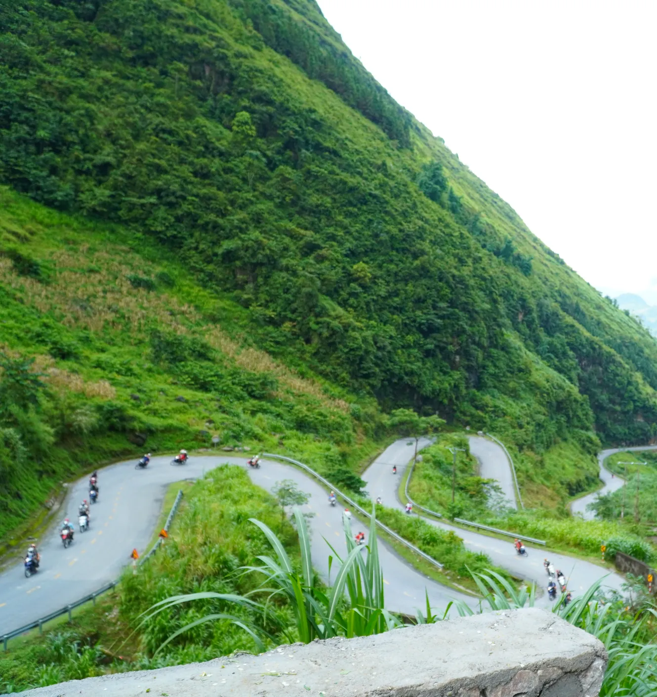
People come to Hà Giang for a view and leave talking about a road.
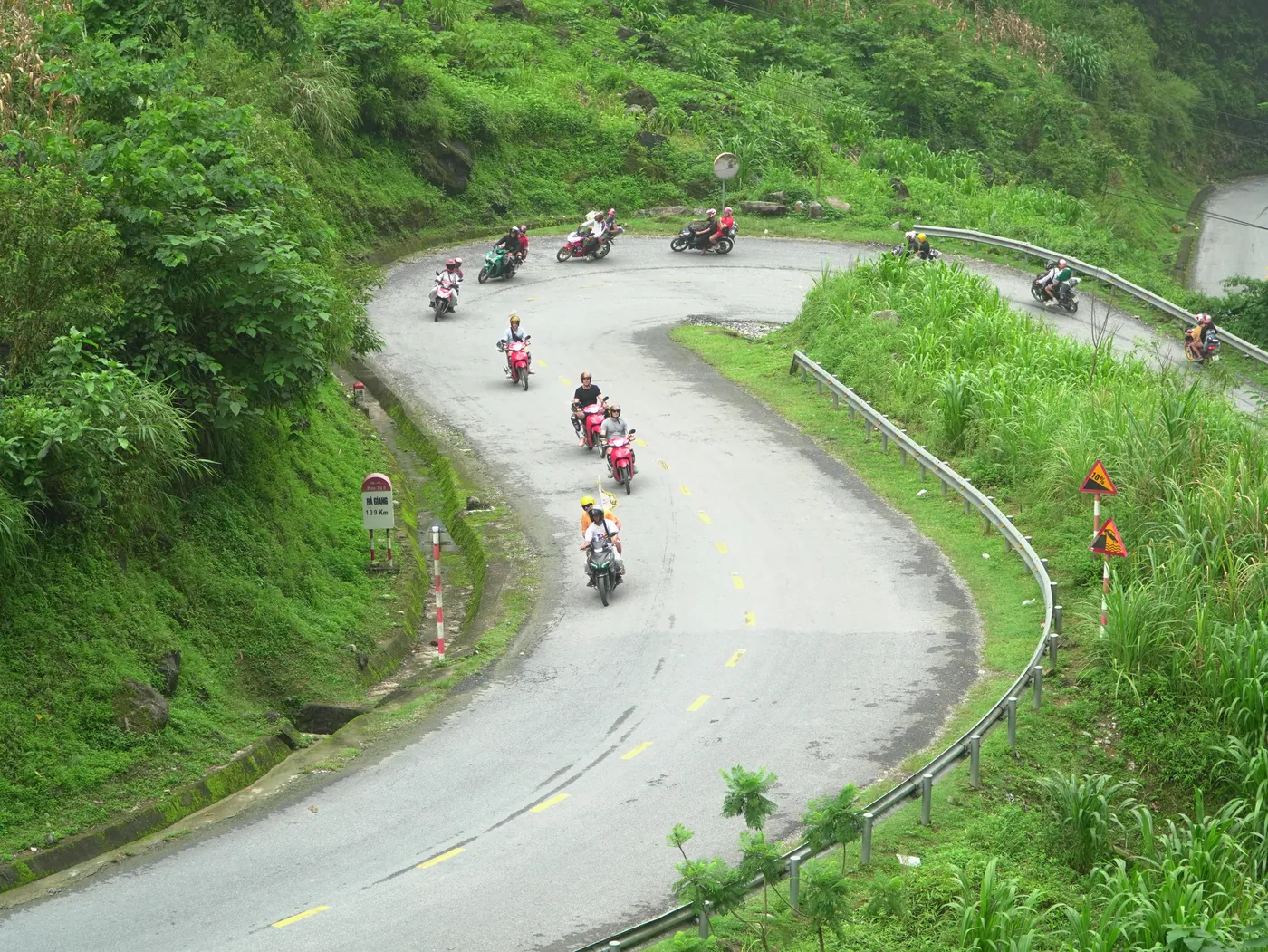
Mã Pí Lèng is the part they remember. A few kilometres of tarmac cut into a cliff face, with a gorge dropping away on one side and rock going straight up on the other. Ride it once and you understand why it’s on every poster.
What almost nobody tells you is how it got there. The answer isn’t a construction company. It’s roughly two and a quarter million days of work with hand tools, and fourteen people who didn’t come home.
The short version
- Mã Pí Lèng is a section of a 185 km road called Đường Hạnh Phúc — the Happiness Road — built between 10 September 1959 and March 1965.
- It was cut by hand. Báo Tuyên Quang records over 2.24 million person-days and nearly 3 million cubic metres of rock and earth moved, with workers roped at the waist and hanging against the cliff.
- Fourteen people died building it — “Đã có 14 người hy sinh”, in that paper’s words. That figure is theirs, published 11 September 2024, and it is about the 1959–65 construction, not about anything that happens on the road today.
- The pass section alone took nearly two years and over a thousand young people from Mèo Vạc, according to the Ministry of Culture, Sports and Tourism.
- It has been a ranked national scenic landmark since 16 November 2009 — Quyết định số 4194 — protecting 796.25 hectares across three communes.
- One altitude is published, and it is not the road. The Ministry’s 2009 ranking gives 1.500m so với mặt nước biển for the đỉnh núi — the summit of the ranked area. No road-surface altitude for the pass is published anywhere, and I explain below what that distinction costs you.
- For the route, the day-splits and the distances, this page defers to the loop map. It does not repeat them.
What is Mã Pí Lèng, actually?
It is a mountain pass in the far north of Vietnam, and it is a piece of civil engineering. Those two facts are usually presented separately, which is why the place gets described as scenery.
The pass carries a stretch of Đường Hạnh Phúc, the Happiness Road, which runs 185 km from Hà Giang up into the stone plateau. Before it existed, the communities up here were reached on foot. The road is the reason there is a loop at all, and Mã Pí Lèng is the hardest thing on it.
On one side the ground falls away to the Nho Quế. On the other it goes up. There is not much shoulder, and in places the drop starts where the tarmac stops — that is my own reading of the road, not a figure from a survey.
The river in the gorge below has its own page — what the boat costs and why the water isn’t the colour you expect. This page stays up on the road.
What did the Happiness Road cost to build?
More than any English-language page about this pass tends to say, and the figures are published — in Vietnamese, by the newspaper of the province the pass now sits in.
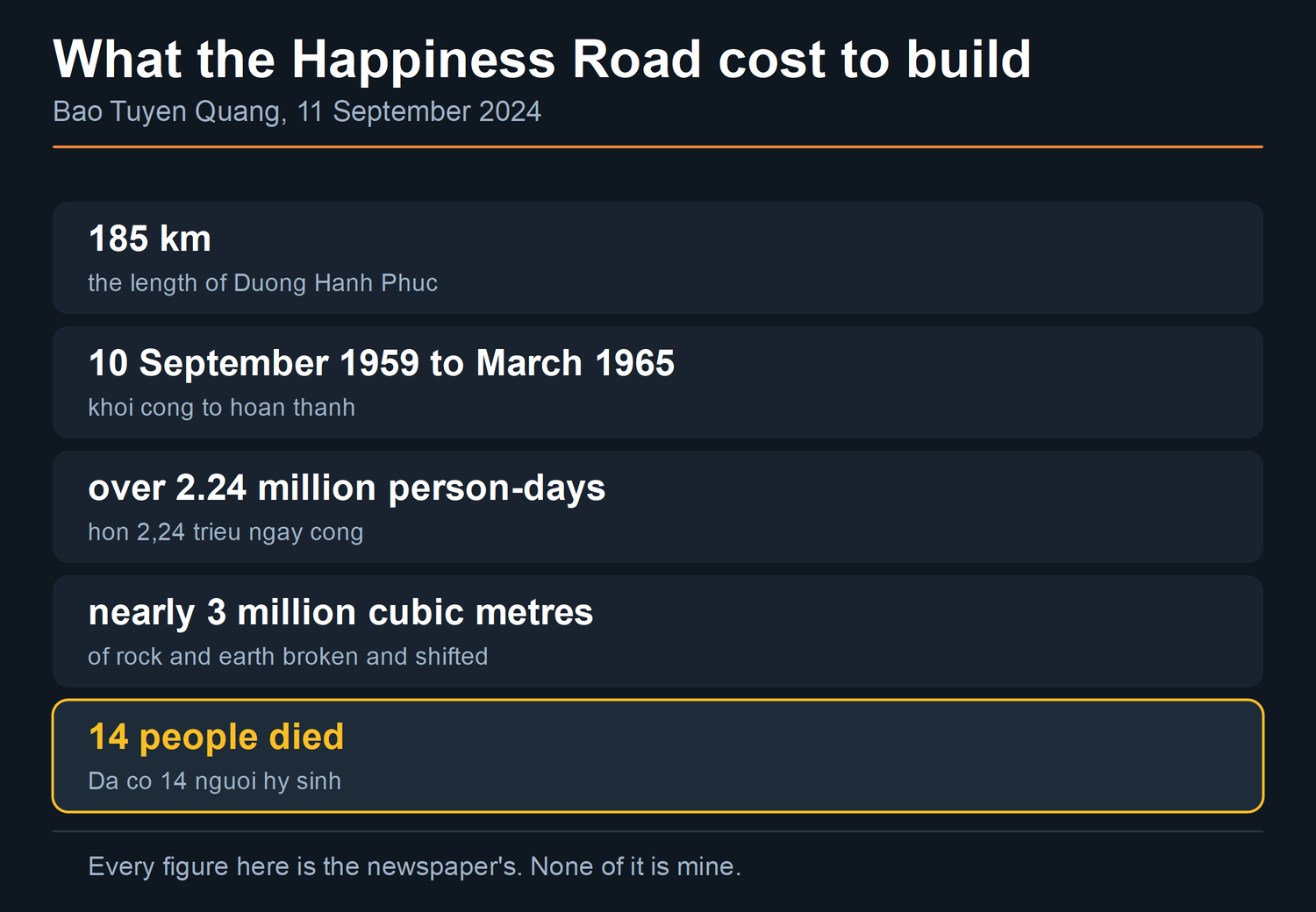
Báo Tuyên Quang, writing on 11 September 2024, gives the start as 10 September 1959 and says of the finish: “cho đến tháng 3.1965 mới hoàn thành” — it was not completed until March 1965.
The same account puts the labour at “hơn 2,24 triệu ngày công đào, phá gần 3 triệu mét khối đá, đất”. That is over 2.24 million person-days of digging. Nearly 3 million cubic metres of rock and earth, broken and shifted.
The workers were thanh niên xung phong, youth volunteer brigades. They came from Cao Bằng, Bắc Kạn, Lạng Sơn, Thái Nguyên, Tuyên Quang and Hà Giang, and from Nam Định and Hải Dương. They worked alongside local people from the ethnic groups already living here.
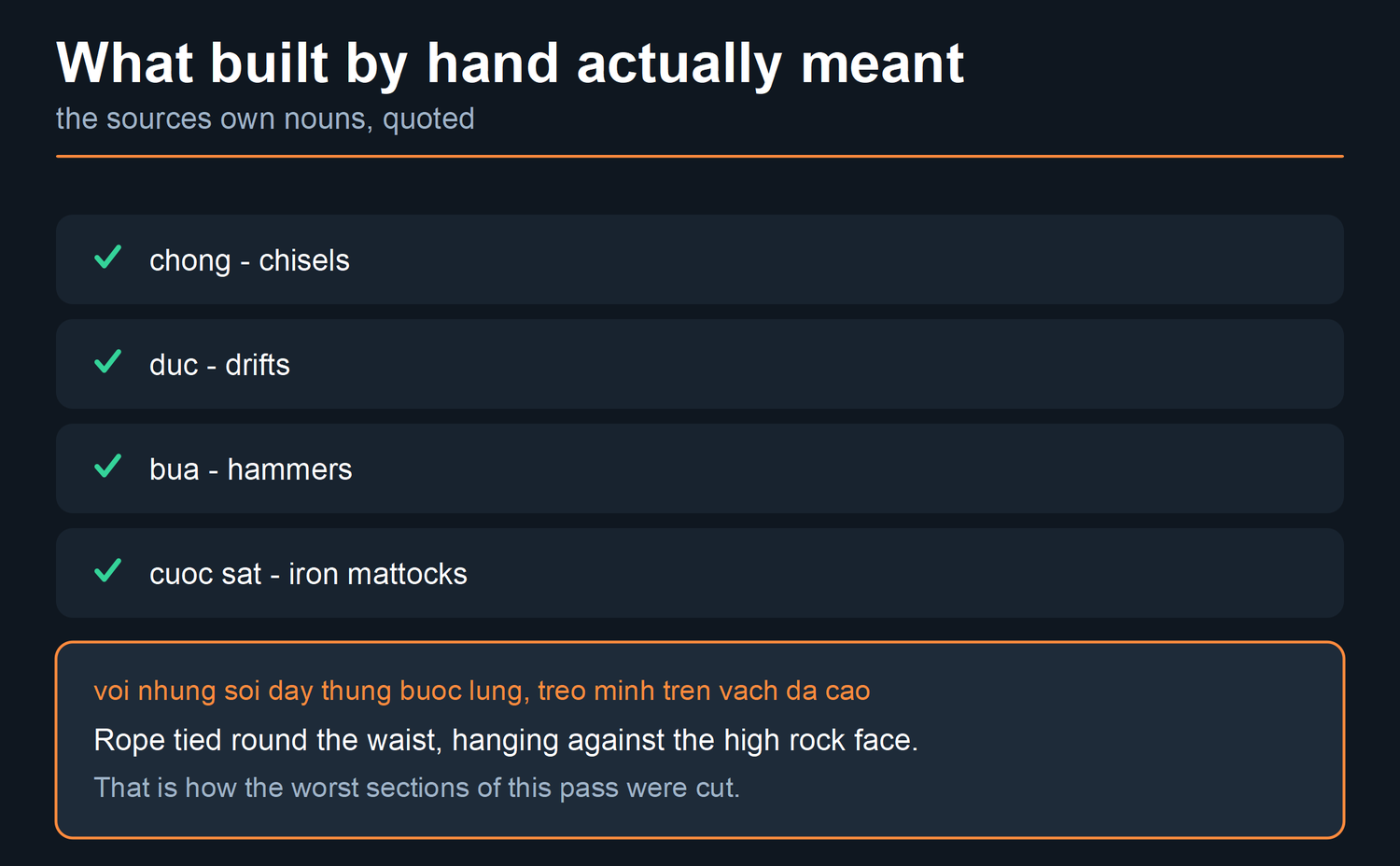
The tools were “chòng, đục, búa, cuốc sắt” — chisels, drifts, hammers and iron mattocks. On the worst sections they were used “với những sợi dây thừng buộc lưng, treo mình trên vách đá cao”. Rope tied round the waist, hanging against the high rock face.
Fourteen people were killed. Báo Tuyên Quang’s sentence is “Đã có 14 người hy sinh” — fourteen people gave their lives. That is their figure, from their article of 11 September 2024, and I am not going to round it or decorate it.
It refers to the 1959–65 construction. It has nothing to do with what happens on this road today, and anyone who sees those two things joined in a sentence should distrust the page they are reading. Modern risk is a separate subject with separate evidence, and it is on its own page.
How long did the pass itself take?
Nearly two of the road’s five and a half years, for that one section.
This comes from the Ministry of Culture, Sports and Tourism‘s own website, in a piece dated 23 December 2009. It calls the pass section the mark of “Cuộc trường trinh phá đá mở đường Hạnh phúc” — the long march of breaking rock to open the Happiness Road. The work was done with hammers and crowbars, over five continuous years, by “trên 1.000 thanh niên Mèo Vạc”: over a thousand young people from Mèo Vạc. And the pass section alone took “gần 2 năm mới hoàn thành đoạn đèo” — nearly two years to finish.

Put the two accounts beside each other and the shape of the job appears. A 185 km road took five and a half years. A few kilometres of it took nearly two.
One date is not settled, and I would rather say so. Báo Tuyên Quang gives the completion as March 1965. Other Vietnamese accounts give 15 June 1965. I have not been able to trace the June date to a publisher I would name, so this page uses March 1965 and tells you the other one exists.
What altitude is actually published, and what does it measure?
One figure is published by an authority. It is not the one most people are looking for.
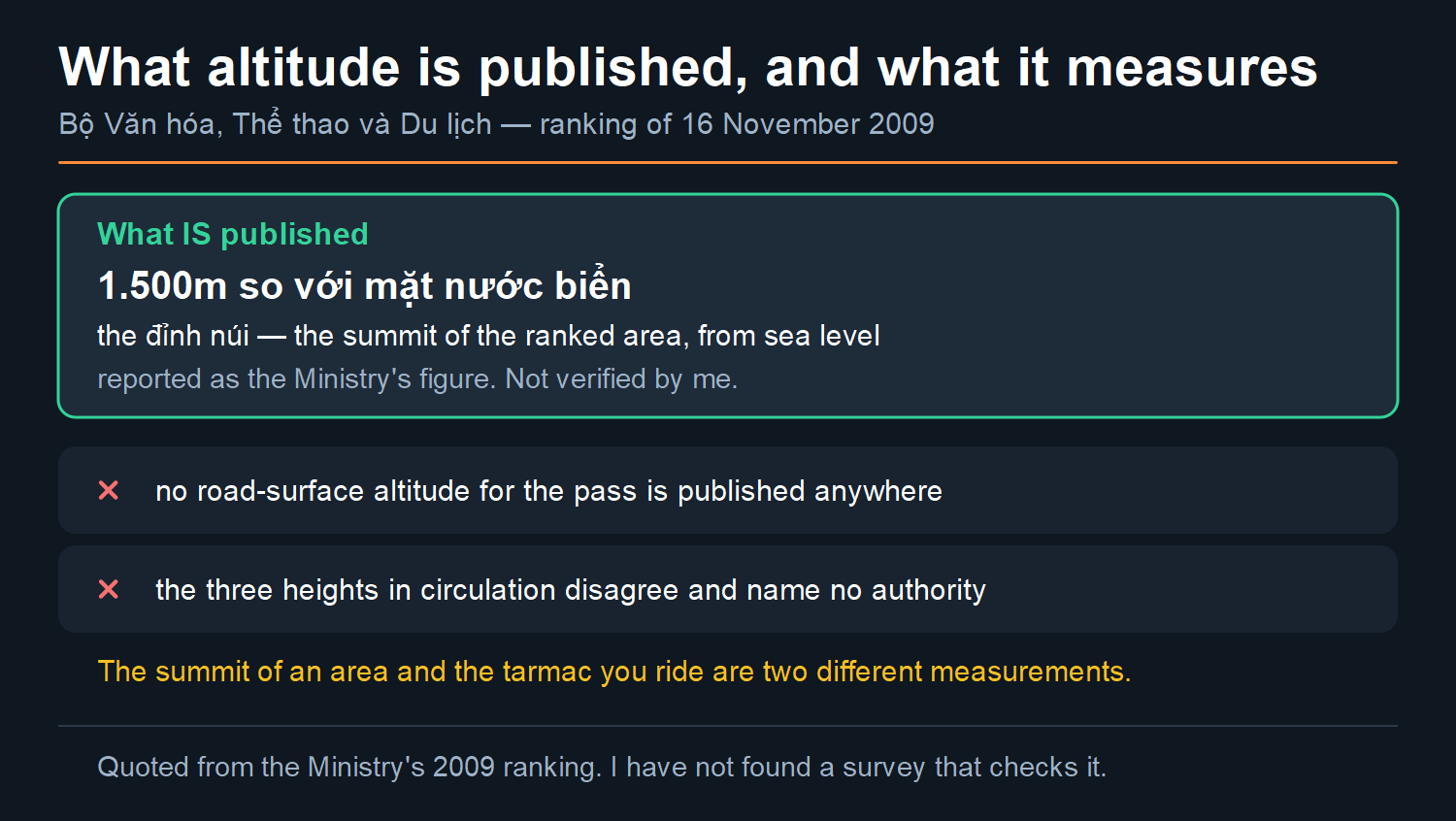
The Ministry of Culture, Sports and Tourism publishes one. In the 16 November 2009 ranking this page quotes further down, the site is described as “đồng thời nằm trên đỉnh núi cao 1.500m so với mặt nước biển” — sitting on a mountain peak 1,500 m above sea level.
Read what that measures. It is the đỉnh núi — the summit of the ranked landmark area — taken from sea level. It is not the height of the tarmac you ride across.
I am reporting it as the figure the Ministry published, on the date it published it. I am not telling you it has been verified, and I have not found a survey that checks it.
For the road surface itself there is nothing. No survey, no map sheet and no mapping authority publishes a road-surface altitude for this pass. The heights you will find quoted for it — I found three — disagree with each other, and none is attached to an authority.
The same pattern hits the plateau underneath. A range gets repeated across a lot of pages and does not appear on the source everyone implies it came from, so this site has a standing rule against printing it.
It is also, honestly, not a number you need. You are not flying a plane over it. What matters on this pass is the width of the road, the weather, and whether you are comfortable on a bike — and none of that changes with a figure in metres.
It is a ranked heritage site, on paper naming a province that no longer exists
On 16 November 2009 the Ministry of Culture, Sports and Tourism signed Quyết định số 4194. It ranks Mã Pí Lèng as a national scenic landmark, a di tích danh lam thắng cảnh Quốc gia. The ministry spells it Mã Pì Lèng.
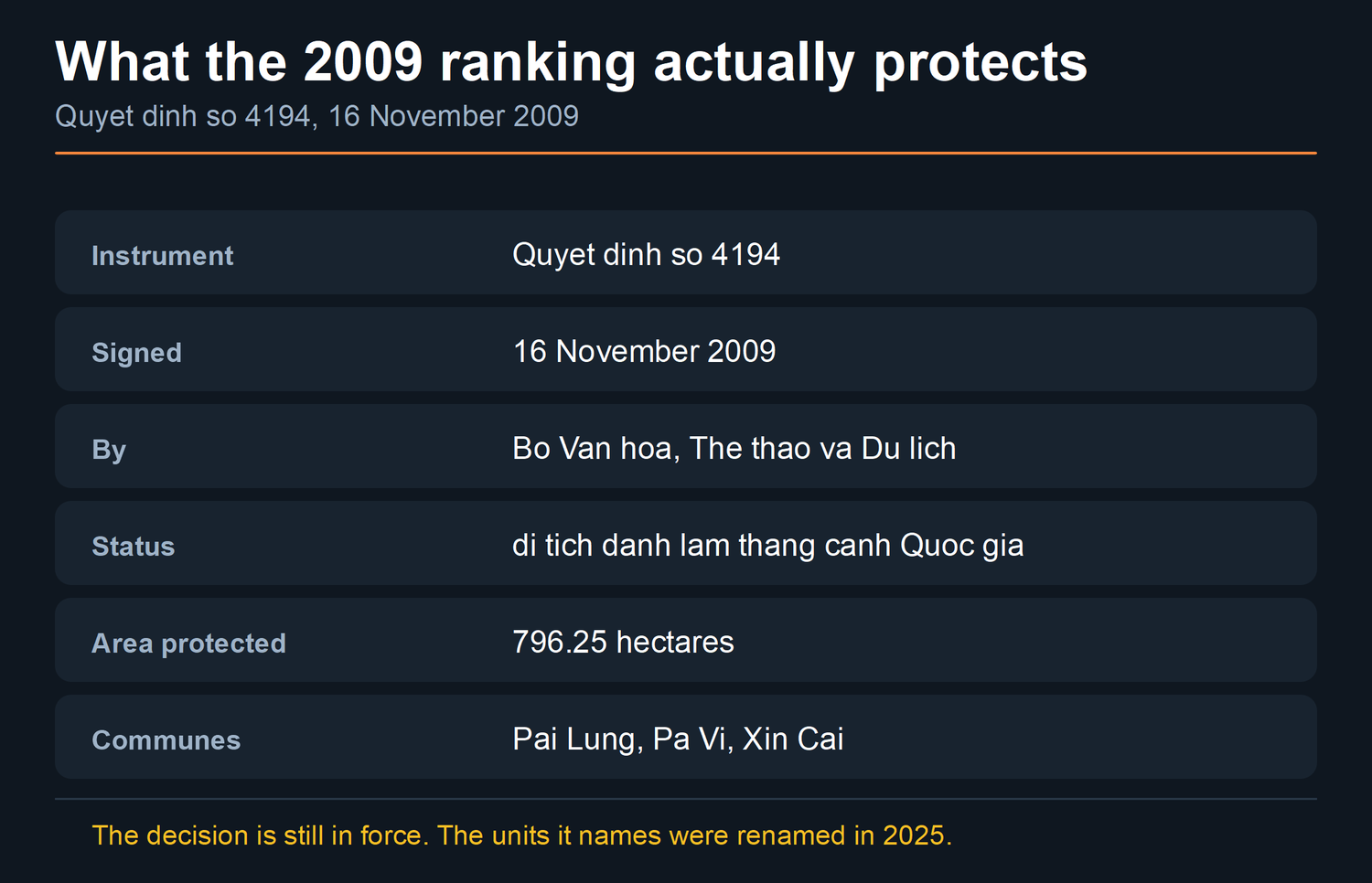
The ranking covers three communes — Pải Lủng, Pả Vi and Xín Cái — and protects 796.25 hectares.
Now read where the ranked area is placed. The ministry’s own 2009 write-up locates it in huyện Mèo Vạc, tỉnh Hà Giang — Mèo Vạc district, Hà Giang province. I should be exact about what I am reading: the decision itself I have not been able to obtain, so what is quoted here is the ministry’s published account of it, not the instrument.
Neither of those units exists any more. Hà Giang stopped being a province on 1 July 2025, and the district tier was abolished nationwide in the same reform. Resolution 60-NQ/TW of the Party Central Committee, dated 12 April 2025, set the plan; I have no public URL for it, so it is named here and not linked. The National Assembly is what enacted it, in Nghị quyết 202/2025/QH15, passed on 12 June 2025. It took 63 province-level units down to 34 — 28 tỉnh and 6 thành phố. Mèo Vạc is now a commune of Tuyên Quang.

The decision is still in force. It simply describes the geography in units that were renamed sixteen years after it was signed. That is ordinary for a long-lived legal document, and confusing for a traveller trying to search for one. The page on what Hà Giang is and what it is called now has the instruments and the dates in full.
Looking for anything official about this pass — a closure, a protection notice, a works order? Search Tuyên Quang as well as Hà Giang. And search Mã Pì Lèng as well as Mã Pí Lèng: Vietnamese sources use both spellings, government ones included.
When should you not ride it?
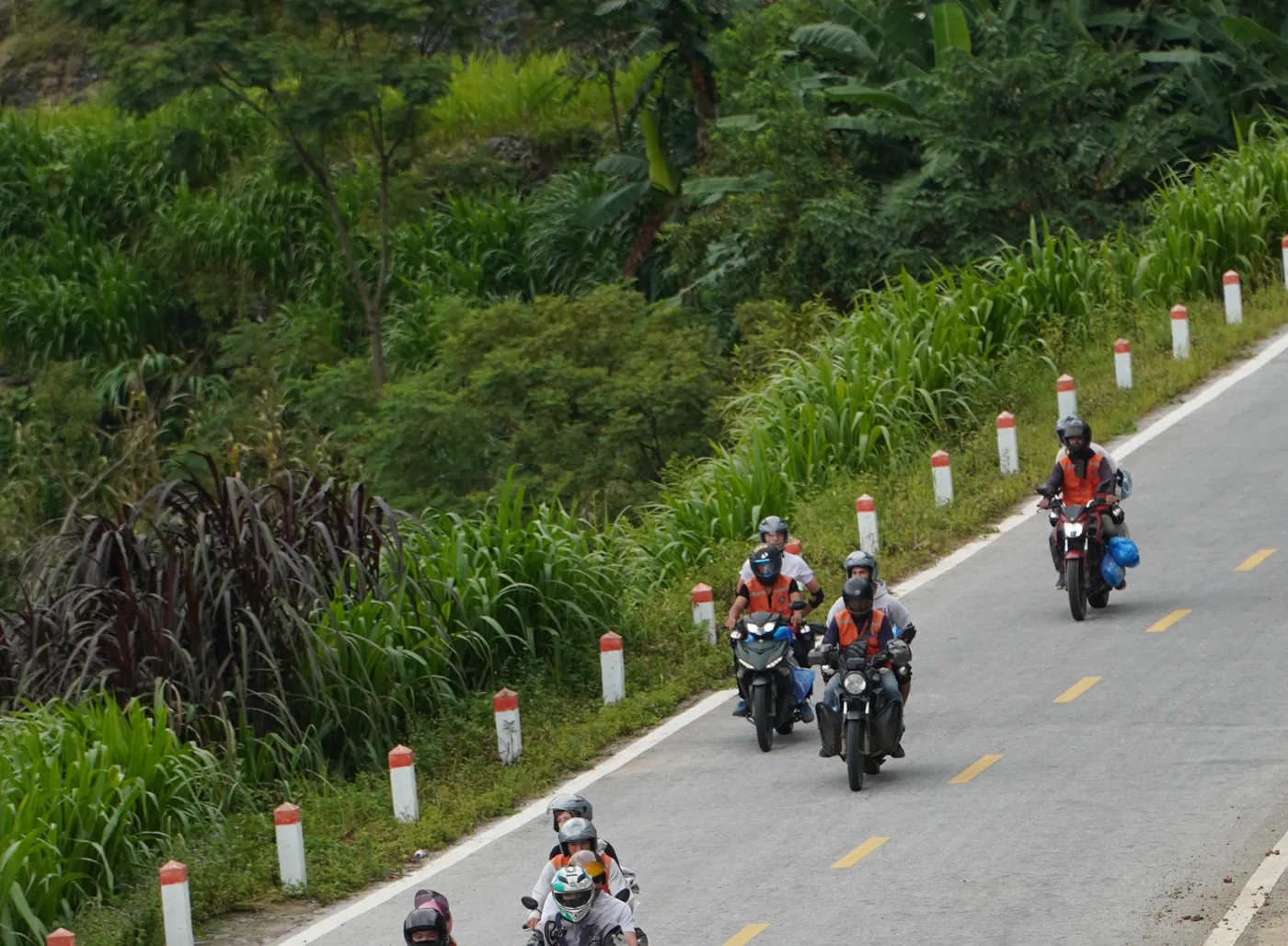
Three conditions, and none of them is about bravery.

In heavy rain or low cloud. The UK Foreign, Commonwealth & Development Office’s Vietnam travel advice puts the rain season in the north at June to September. It warns that “Roads may become blocked due to mudslides and landslides.” On an exposed cliff section, that is not an inconvenience.
Late in the day. Nothing about this road improves in failing light. There are wide places where stopping is sensible, but they are rarely where the view is best, and in failing light you will not be picking carefully. That is my judgement, not a measurement.
If you have never ridden a manual or semi-automatic bike before. The FCDO’s own wording is “Do not hire a motorbike if you’re not an experienced rider.” That is a government’s advice to its own citizens, not mine. I would rather hand you theirs than dress my opinion up as a warning.
If any of that rules you out, the pass is entirely doable from the back of somebody else’s bike or from a car seat. That is a real option, not a consolation prize — and you should know that We sell tours on this loop, so I am not disinterested in telling you so.
For where the pass falls in a day and how to plan around it, that is the map page’s job, and it does it properly: the route, the legs and the day-splits. For when in the year to come, the weather page.

Common questions
What is the Happiness Road?
Đường Hạnh Phúc, a 185 km road from Hà Giang into the stone plateau, begun on 10 September 1959 and, per Báo Tuyên Quang, not completed until March 1965. Mã Pí Lèng is its most exposed section. Some Vietnamese accounts date the completion to 15 June 1965 instead; I have not traced that one to a publisher I would name.
How many people died building Mã Pí Lèng?
Báo Tuyên Quang, on 11 September 2024, writes “Đã có 14 người hy sinh” — fourteen people died. That is their published figure and not mine, and it belongs to the 1959–65 construction. It says nothing about riding the road now; that is a separate page with separate evidence.
How high is Mã Pí Lèng pass?
One altitude is published and this page prints it: the Ministry’s 2009 ranking gives 1.500m so với mặt nước biển for the đỉnh núi, the summit of the ranked area. I report that as the Ministry’s figure and I have not found a survey that checks it. What does not exist is a road-surface altitude for the pass — the figures in circulation disagree with each other and none that I found is attached to a survey or a mapping authority. This site also has a standing rule against repeating the unsourced range published for the plateau, and that rule stands.
Is Mã Pí Lèng protected?
Yes. Quyết định số 4194 of 16 November 2009 ranks it a national scenic landmark. Signed by the Ministry of Culture, Sports and Tourism, it protects 796.25 hectares across the communes of Pải Lủng, Pả Vi and Xín Cái.
Is it in Hà Giang or Tuyên Quang?
Physically it has not moved. Administratively it is in Tuyên Quang: Hà Giang ceased to be a province on 1 July 2025 under Nghị quyết 202/2025/QH15, passed 12 June 2025, and the district tier went at the same time. Documents written before that — including the 2009 ranking — still say Mèo Vạc district, Hà Giang province, and they remain valid.
Can I do the pass without riding a motorbike myself?
Yes, as a passenger or by car. Read what a package actually buys you before you book anything.
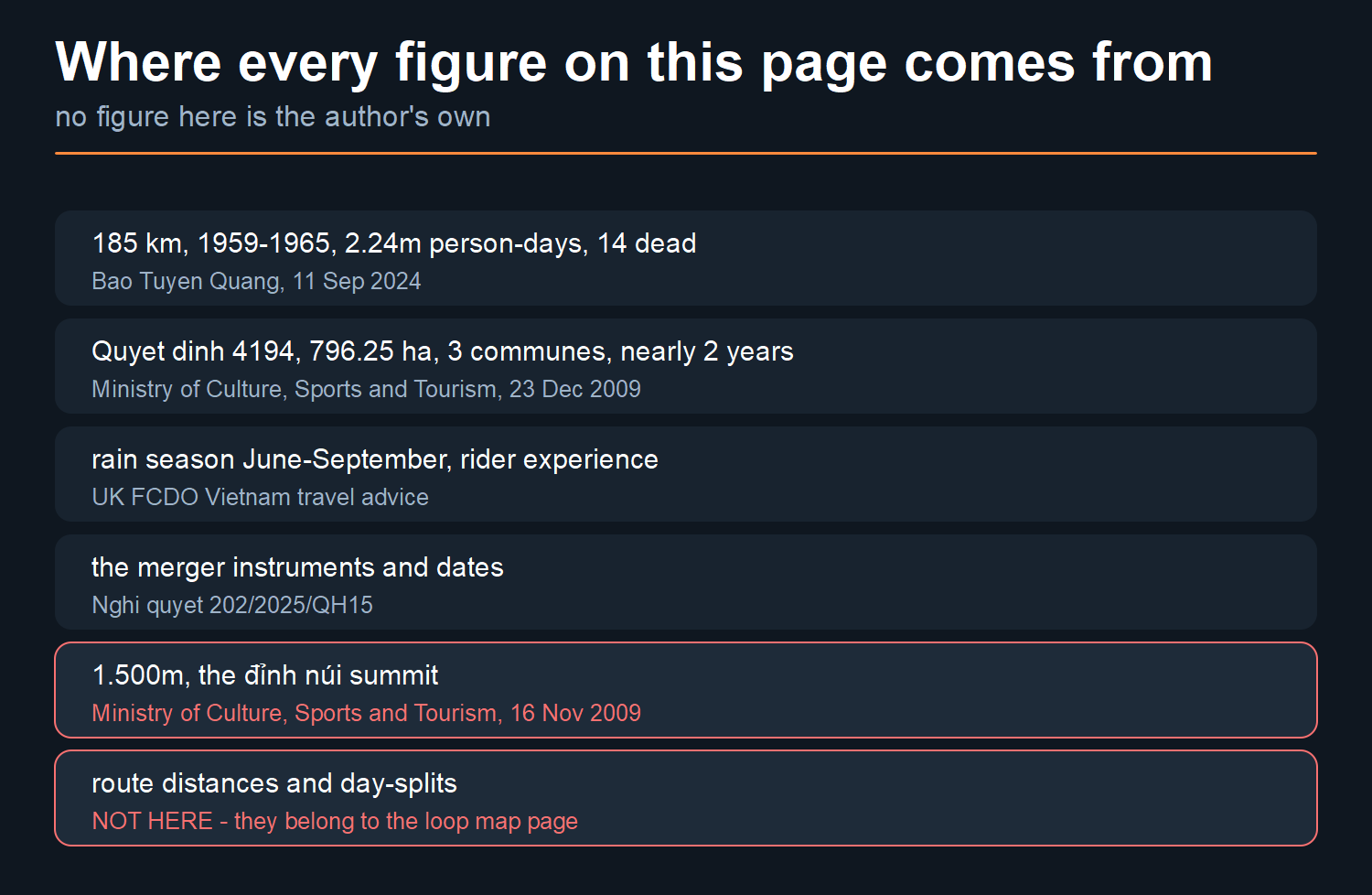
Where the numbers on this page come from. The 185 km, the 10 September 1959 start, the March 1965 completion, the 2.24 million person-days, the nearly 3 million cubic metres, the tools, the rope detail and the figure of fourteen dead all come from one place. That is Báo Tuyên Quang, 11 September 2024, accessed 6 August 2026, linked above. The 796.25 hectares, Quyết định số 4194, the three communes and the “nearly two years” for the pass section come from the Ministry of Culture, Sports and Tourism’s own site. That article is dated 23 December 2009, accessed the same day, and also linked. The rain-season and rider-experience wording is quoted from the UK FCDO’s Vietnam travel advice. The merger instruments are Nghị quyết 202/2025/QH15 and Resolution 60-NQ/TW, and I have been careful to say which of those two actually enacted the change.
What is not here. A road-surface altitude — nobody publishes one. Any distance or day-split for the loop — those belong to the map page, and repeating them here would only put two different versions on one site. And no figure of my own: every number on this page is somebody else’s, and named. The judgements about the road — the shoulder, the light, where it is sensible to stop — are mine, and they are marked as mine where they appear.
Photographs taken between 29 July and 3 August 2026. Diagrams and cards on this page are mine.