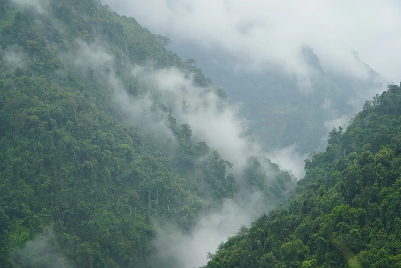
I was born here, and the question I get most often is still the same one.
“So what actually is Hà Giang?”
It’s a fair question. The answer has changed on paper since 2025, and almost nothing online has caught up.
So here’s the honest version: where it is, what’s up there, what it’s called now, and whether it’s worth your week.
The short version
- Hà Giang is the far north of Vietnam, up against the Chinese border, about 300 km from Hanoi by road.
- It stopped being a province on 1 July 2025, when it was merged into Tuyên Quang under Nghị quyết 202/2025/QH15. The district tier was abolished across the whole country at the same time. The city is still called Hà Giang and every place name on the loop is unchanged.
- The landscape is a UNESCO Global Geopark — the Đồng Văn Karst Plateau, 234,500 hectares of it, with a geological history UNESCO puts at more than 550 million years.
- Most people come for the road, a circuit that takes three or four days — my own figures, from working these roads.
- You don’t have to ride it yourself, and a lot of people shouldn’t.
- Foreign travellers need a border area permit for most of the ground the loop crosses — 260.000₫, about US$10, and that figure is mine rather than a published one. If you book through a tour company they arrange it; independently, you buy it yourself.
Where is Hà Giang?
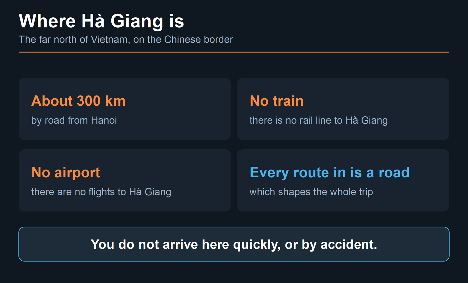
The northernmost part of Vietnam. Push a finger to the top of the map, where the country runs into China, and that is it.
From Hanoi it’s about 300 km by road, on Vietnam Airlines’ own travel guide for the route. There’s no train and no airport, and the way you cover that 300 km matters more than people expect.
Every way in is a road, and that’s the first thing shaping a trip here — you don’t arrive quickly, and you don’t arrive by accident. It also means the journey up is part of the trip whether you wanted it to be or not, and people who treat it as dead time usually regret how they’ve scheduled their first day.
What that distance buys you is the reason people keep coming. The land goes vertical. Rivers cut down through limestone instead of spreading out, villages sit on ridgelines rather than in valleys, and the road has to climb everything rather than go round it.
Wait — is it still called Hà Giang?
Yes and no, and this is the part almost nothing online has updated.
Hà Giang stopped being a province on 1 July 2025. Resolution 60-NQ/TW of 12 April 2025 set the reform; the National Assembly enacted it in Nghị quyết 202/2025/QH15, passed on 12 June 2025, which merged Hà Giang into Tuyên Quang. The new units began operating on 1 July. Nationally it cut Vietnam from 63 province-level units to 34 — 28 provinces and 6 centrally-governed cities. In the same reform the entire district tier was abolished nationwide, so the districts people have been naming in itineraries for years no longer exist as administrative units.
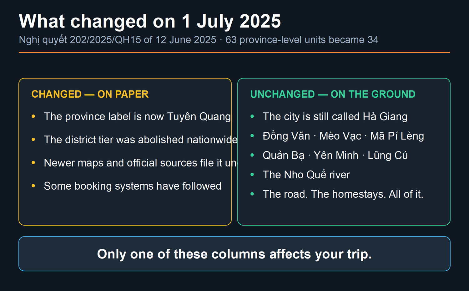
Now the part that matters to you, and it is short: nothing you came for changed.
The city is still Hà Giang. Đồng Văn, Mèo Vạc, Mã Pí Lèng, Quản Bạ, Yên Minh, Lũng Cú and the Nho Quế river all keep their names. The road is the road. The homestays are where they were.
Where it does bite is search and paperwork. Newer official sources, some maps and a few booking systems now file the area under Tuyên Quang. If a search for the province returns nothing sensible, search the city instead. And if an older guide gives you a district name in an address, treat it as a landmark rather than an administrative fact.
I’m not going to pretend this is dramatic. It’s an administrative change and locals mostly carried on. But you should know it, because at some point you’ll see “Tuyên Quang” on something official and wonder whether you’ve booked the wrong place.
What is actually up there
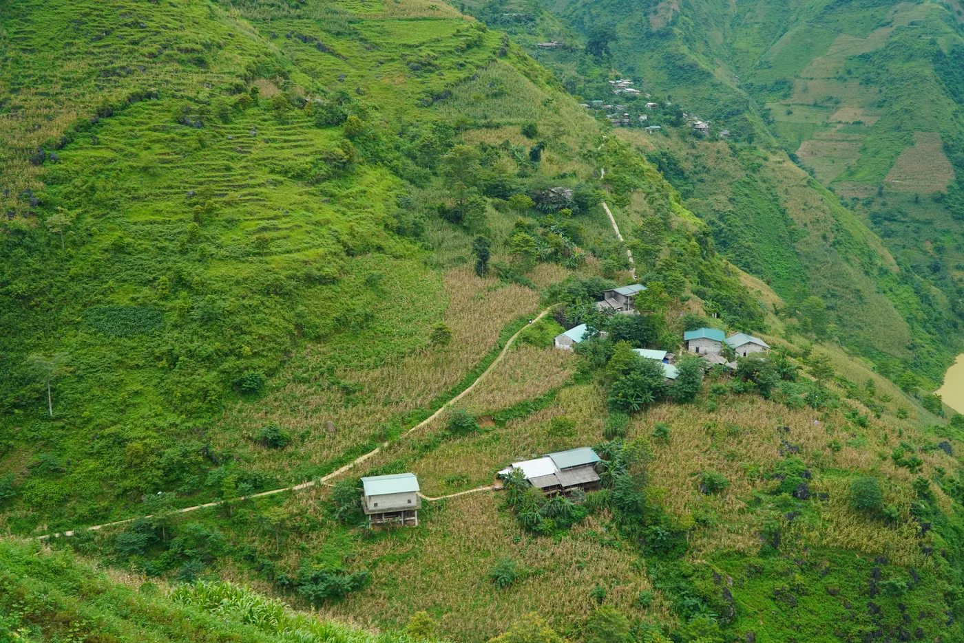
The landscape has a formal name and a formal status, and both are worth knowing because they explain why it looks the way it does.
It is the Đồng Văn Karst Plateau UNESCO Global Geopark. On UNESCO’s own entry it covers 234,500 hectares — call it 2,345 square kilometres. Its geological history, in UNESCO’s words, “spans more than 550 million years, beginning in the Cambrian period.”
The plateau is “dominated by limestone formations (approximately 60%)”, and UNESCO lists fossils found there including ancient fish, trilobites, corals and crinoids.
None of that is trivia. It’s the explanation. Limestone is why the rock stands up in towers instead of sloping, why the rivers run in slots rather than valleys, and why there’s so little surface water on a plateau that gets a great deal of rain. The water goes straight down through the stone. That’s also why the villages sit where they sit, and why people here have always had to think about water in a way visitors never notice.
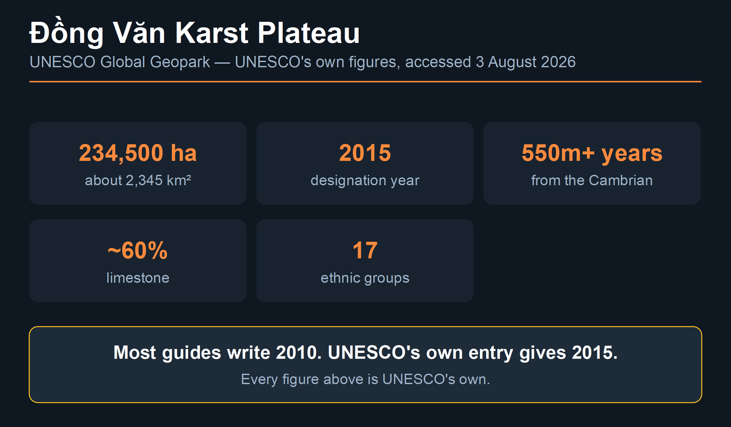
A date worth correcting. You will read almost everywhere that this has been a UNESCO Global Geopark “since 2010”. UNESCO’s own entry gives 2015.
I am not going to tell you what the 2010 figure refers to, because I have not found a source I would stand behind for it. What I can tell you is what UNESCO publishes, and UNESCO publishes 2015.
UNESCO also records 17 ethnic groups living in the geopark, “including the Mong, Lo Lo, Pu Mong, Co Lao, Bo Y, Dao, and Tay.” That is not decoration on a landscape page. It is why the markets look the way they do, why the houses are built differently forty kilometres apart, and why the answer to “what language do they speak here” is not a single language.
Hà Giang city and Hà Giang the region are not the same thing
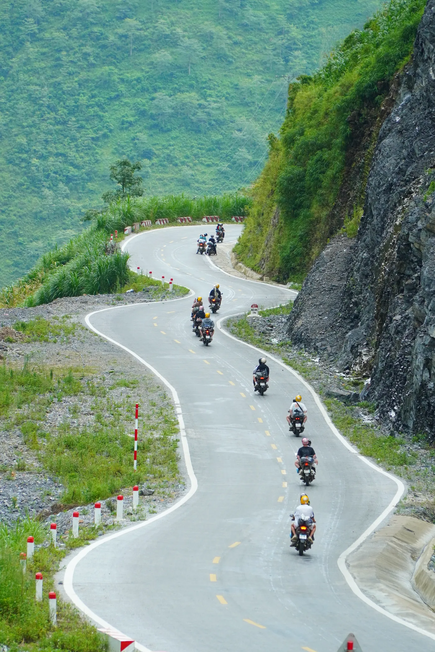
This trips up more bookings than anything else, so it is worth being blunt about.
Hà Giang city is where you arrive, where the buses stop, where you rent a bike or meet your tour, and where you’ll probably sleep the first night. It’s an ordinary working town in a valley. It isn’t the scenery.
The scenery starts about an hour north of it, by my reckoning, and keeps going for days. Everything anyone has ever shown you in a photograph of “Hà Giang” is out on the plateau, not in the city.
Practical version: don’t budget days for the city. Budget a night on either end of the loop and spend everything else on the road. People who plan two days “in Hà Giang” and then discover the town is a town are usually people who’ve read the province name as a place name.
What do people actually go for?
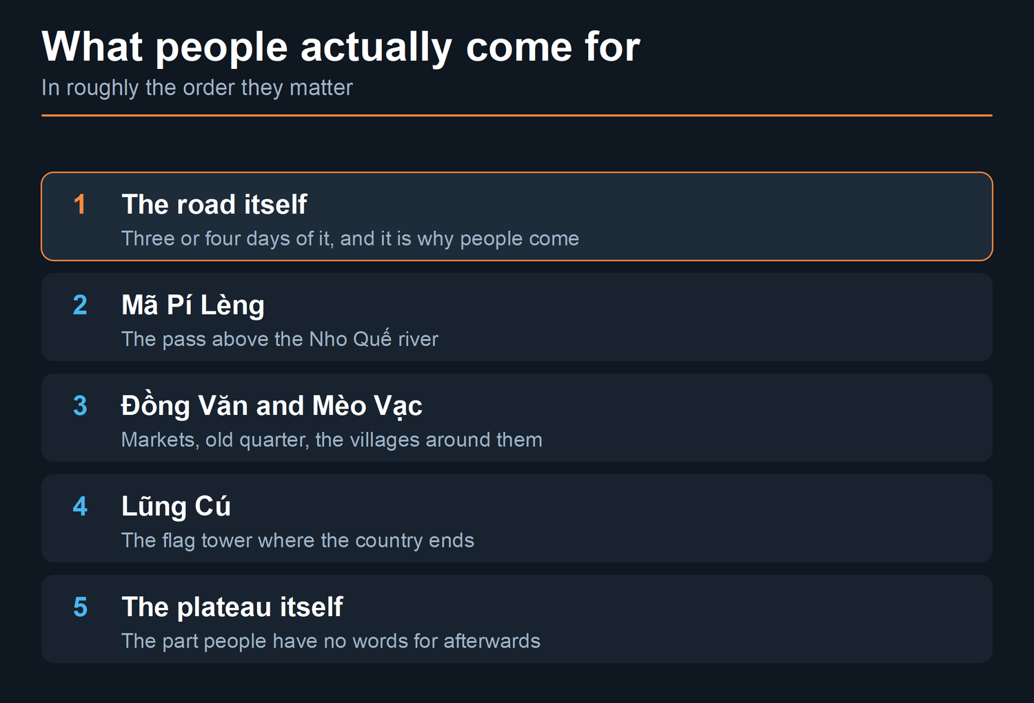
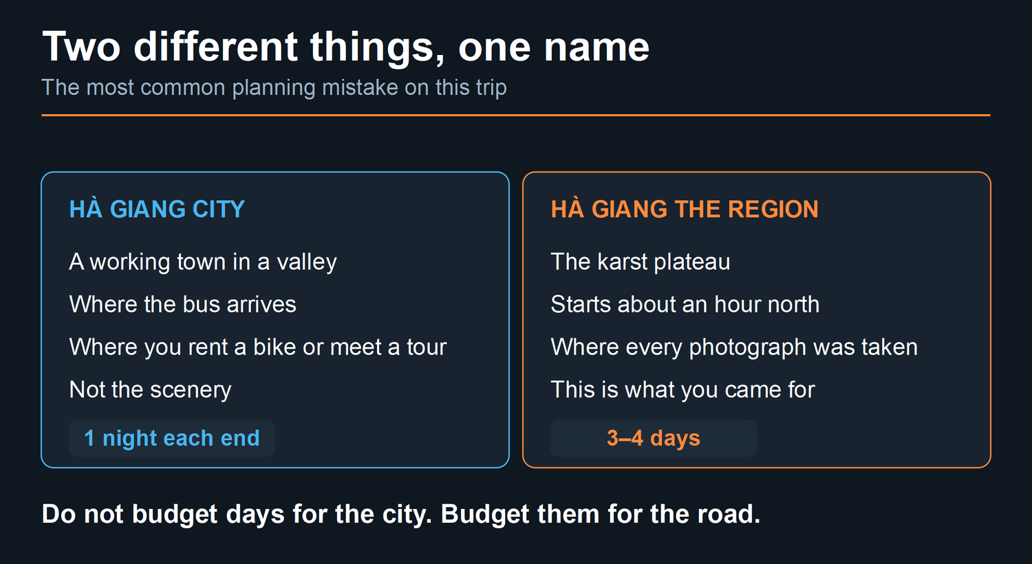
Honestly? The road.
That sounds reductive and it isn’t. Nobody flies to Vietnam to look at tarmac — but what you do here, hour after hour, is move through the landscape rather than stand and look at it, and that turns out to be a different kind of experience from a viewpoint with a car park.
People say they come for the landscape, and the landscape is the reason the road is worth riding, but what they actually do all day is travel through it. The circuit is roughly 450 km including the spur up to Lũng Cú — my figure, from working these roads — and about eight hours a day door to door once you count stops, photographs and lunch. I have set out the whole route, the fuel spacing, and the places Google Maps sends people wrong on a separate page.
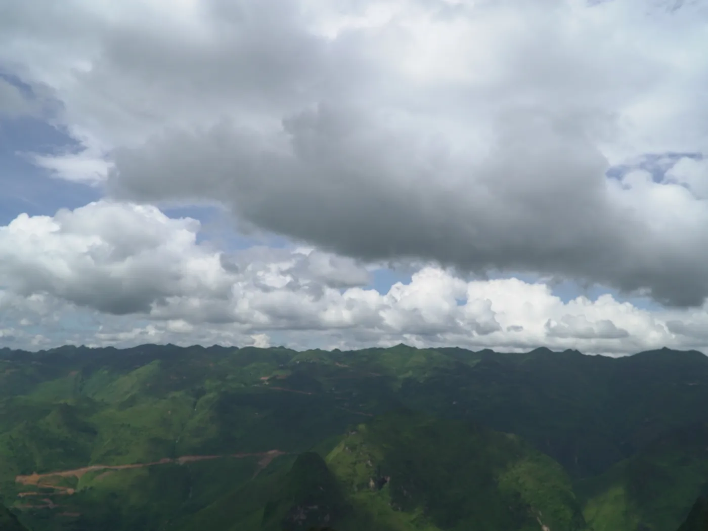
Beyond that: the passes, particularly Mã Pí Lèng above the Nho Quế; the markets and villages around Đồng Văn and Mèo Vạc; the flag tower at Lũng Cú where the country ends; and the plateau itself, which is the part people don’t have words for when they get back.
What paperwork do you need before you go?
This one is easy to miss and it is not optional.
One qualification before anything else: the decree carves out formally designated tourist, service and economic zones. My reading is that the loop’s ordinary roads and villages are not one of those — but that reading is mine, not the decree’s.
As a foreign traveller you need a border area permit for most of the ground the loop crosses. It costs 260.000₫ — about US$10 at 26.287,25₫ to the dollar, 3 August 2026. That figure is mine, from working here in August 2026. Book through a tour company and they buy and register it for you. Travel independently and you buy it yourself.
It is not a new rule, whatever you read. Vietnam has required it since 15 June 2014 under Nghị định 34/2014/NĐ-CP, and the current text is Nghị định 299/2025/NĐ-CP, in force 17 November 2025. What changed in 2026 is that people started being checked — that last part is my own observation, not a date in any decree.
The part that catches people is where the zone starts. It is not up at Đồng Văn — by my reckoning you are inside it within the first hour out of Hà Giang city. There is a summary on the route page.
How long do you need?
Three or four days on the road, plus your travel at each end. Those are my own splits, from working the route out.
Four divides the distance evenly; three works but makes the last day long. I set out the day-by-day splits, the overnight stops and why five is a waste of your money on the route page.
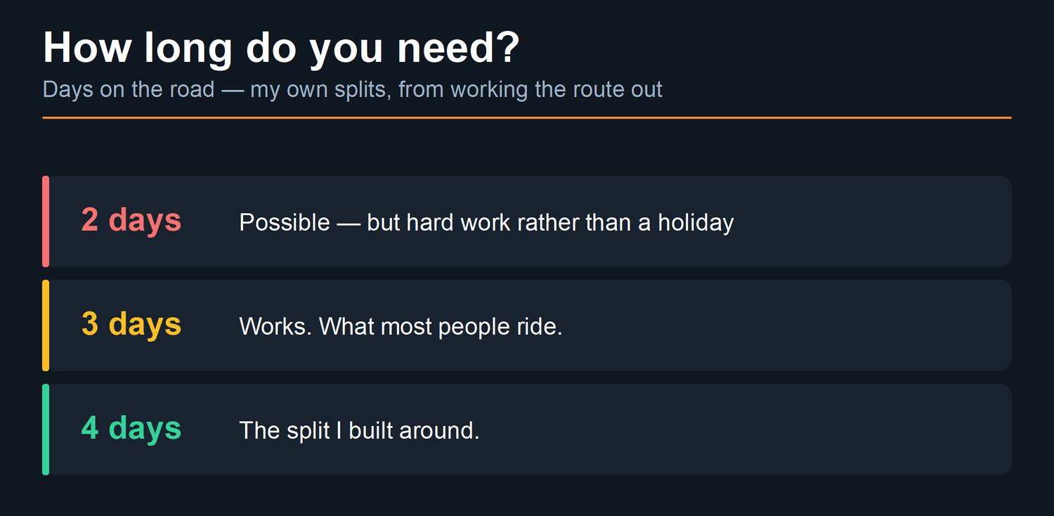
Add a day at the front if you arrive overnight and want to start rested, and a day at the back if you are carrying on to anywhere that is not Hanoi.
When should you go?
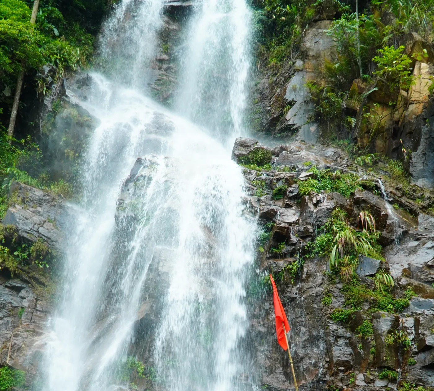
Short answer: autumn is the popular window, and summer is greener and wetter than most people expect.
The UK Foreign Office puts the tropical cyclone season across Vietnam at May to November, with the northern rain season June to September, and warns that “Roads may become blocked due to mudslides and landslides.” That is the honest shape of the year: the wet months are not unrideable, they are just wetter, greener, and occasionally interrupted.
I won’t give you a single month here. The right one depends on whether you’re optimising for dry roads, for clear views, or for the terraces being full — and those three don’t peak together. That’s a whole article on its own.
Is it worth it if you don’t ride a motorbike?

Yes, and this is where I part company with most of what is written about this place.
You don’t have to drive to see Hà Giang. You can ride as a passenger behind a hired local driver, take a private car, or put a group or a family in a jeep. The road is the same road, and the plateau doesn’t care who’s holding the handlebars.
There is also a legal dimension that catches people out. Driving a motorbike here needs paperwork most visitors do not arrive with — the UK Foreign Office requires a 1968 international driving permit alongside your own licence — and I have written separately about what the ride-style choice actually costs and what it actually changes. If you have been assuming you would rent a bike, read that first.
And if you are weighing whether any of this is safe, I have set out where the risk on this road genuinely concentrates, including which parts of it you control and which you don’t.
Common questions
Where is Hà Giang in Vietnam?
In the far north, on the Chinese border, about 300 km by road from Hanoi. There is no train and no airport, so every route in is by road.
Is Hà Giang still a province?
No. Resolution 60-NQ/TW of 12 April 2025 set the reform. The National Assembly enacted it in Nghị quyết 202/2025/QH15 on 12 June 2025, and the new units began operating on 1 July, when Hà Giang was merged into Tuyên Quang. Nationally it cut 63 province-level units to 34. The district tier was abolished at the same time. The city is still called Hà Giang and no place name on the loop changed.
What is Hà Giang known for?
The Ha Giang Loop, a road circuit through the Đồng Văn Karst Plateau UNESCO Global Geopark, and the ethnic-minority communities living across it — UNESCO records 17 ethnic groups within the geopark.
Is Hà Giang a UNESCO site?
The Đồng Văn Karst Plateau is a UNESCO Global Geopark. UNESCO’s own entry gives the designation year as 2015 and the area as 234,500 hectares. Many guides say 2010; that figure is not on UNESCO’s page and I have not found a source for it I would stand behind.
How many days do you need in Hà Giang?
My own judgement, from splitting this route: three or four on the road, plus travel at each end. Three works but makes the last day very long; four divides the distance evenly. Five is too many.
Is Hà Giang city worth staying in?
For a night at each end, yes, because that is where the road starts and finishes. It is a working valley town, not the scenery. The landscape people come for begins about an hour north of it — my reckoning, not a measured figure.
A note on this page. The geopark figures — area, designation year, geological span, limestone proportion and the list of ethnic groups — are quoted from UNESCO’s own entry for the Đồng Văn Karst Plateau UNESCO Global Geopark, accessed 3 August 2026. The season dates and the landslide warning are the UK Foreign, Commonwealth & Development Office’s, accessed the same day. The 300 km from Hanoi is Vietnam Airlines’ own figure for the route.
The merger: Resolution 60-NQ/TW of 12 April 2025 set the reform and Nghị quyết 202/2025/QH15 of 12 June 2025 enacted it, with the new units operating from 1 July. The border permit: Nghị định 34/2014/NĐ-CP, in force 15 June 2014, as amended by Nghị định 299/2025/NĐ-CP, in force 17 November 2025. All accessed 4 August 2026 and linked where they appear.
The permit fee of 260.000₫ is converted at 26.287,25₫ to the US dollar, XE.com, 3 August 2026.
I have deliberately not published an average altitude for the plateau. The 1,000–1,600 m range you will see repeated is not on UNESCO’s page and I do not have a source for it I would stand behind. UNESCO does publish figures for individual features; I have not reached for those either, because this page is an orientation and not a geology lesson.
The distances, day-splits and the judgement about five days being too many are my own, from working these roads. They are stated as approximations because that is what they are.
The photographs were taken on our own trips between 27 and 31 July 2026, and each caption carries its own date.