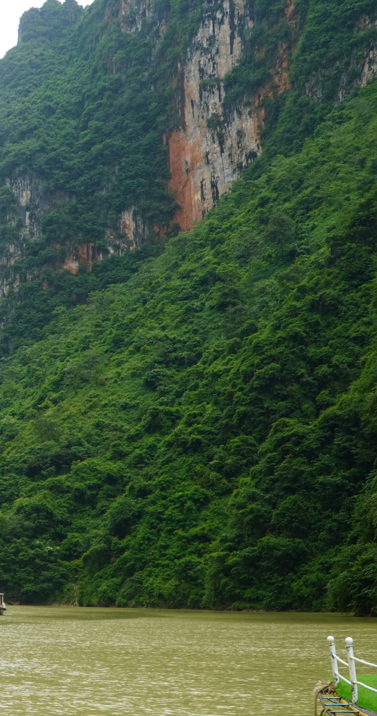
You have seen this river before you get here. It is the emerald ribbon in the drone shot, the one that made you put Hà Giang on the list in the first place.
Then you pay for the boat, you come round the first bend, and the water is the colour of weak tea.
Nobody warns you about that, and the price you were quoted is wrong too. Both of those have straightforward explanations. One of them isn’t what you’d guess. The stretch of water you’re floating on is held behind a dam, and the company that owns the dam sets the fare.
The short version
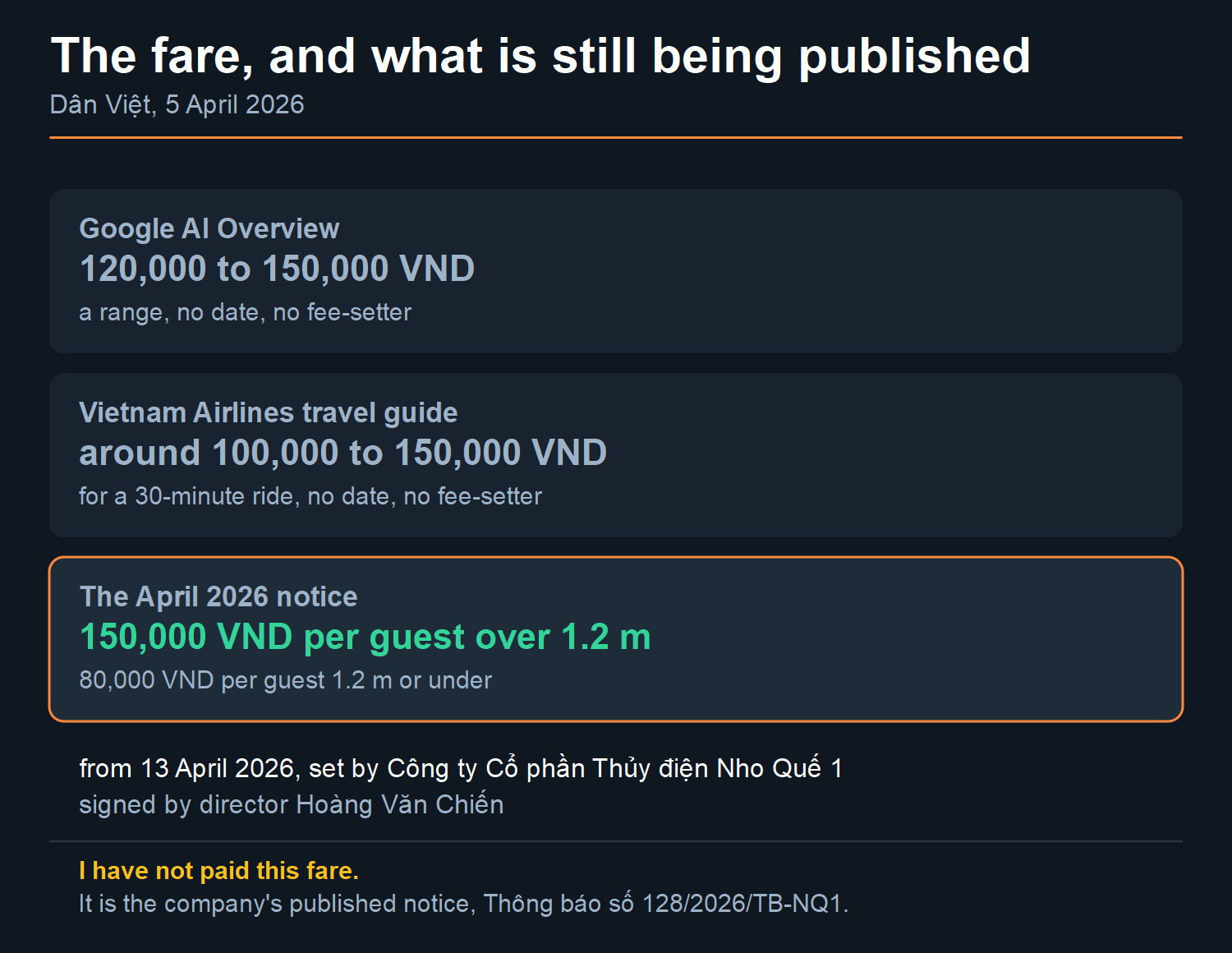
- The boat fare is 150,000₫ — about US$5.72 at 26,217.41₫ to the dollar, 18:48 UTC on 6 August 2026 — for anyone over 1.2 m tall, and 80,000₫ (about US$3.05) at 1.2 m or under. It has been that since 13 April 2026.
- That fare was set by a hydropower company, Công ty Cổ phần Thủy điện Nho Quế 1, underneath a management plan written by the district People’s Committee and extended by the commune. Reported by Dân Việt on 5 April 2026.
- I have not paid that fare myself, and this site holds no receipt for it. No figure on this page is mine, and each one names the publisher I took it from.
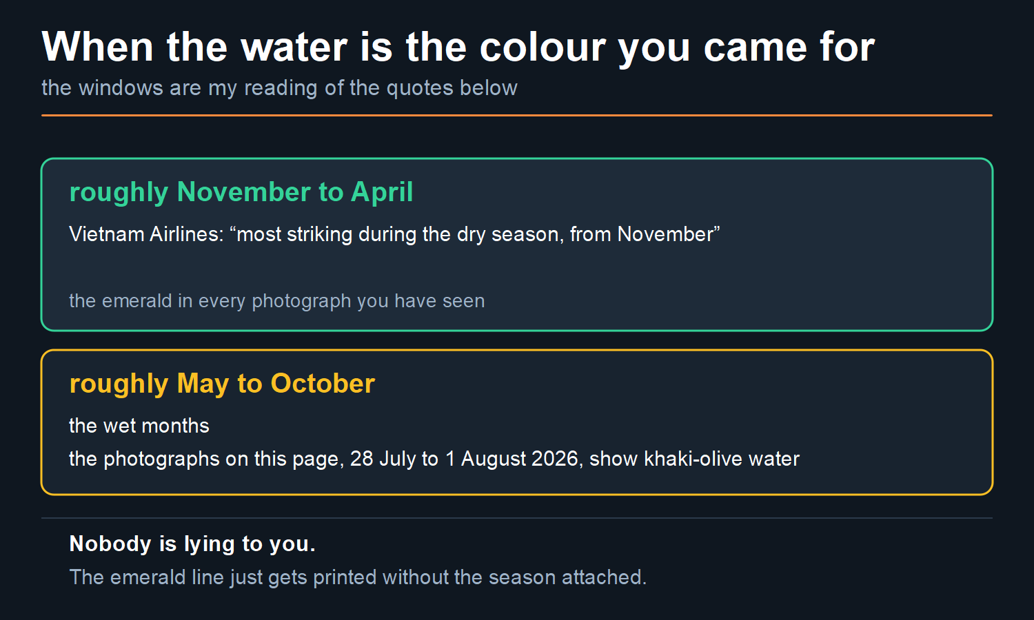
- The famous green is a dry-season colour. Vietnam Airlines’ own guide says it is “most striking during the dry season, from November”. The photographs on this page, shot between 28 July and 1 August 2026, show it khaki. Both things are true at once.
- You are on a reservoir, not a free-flowing river, on the stretch the boats work.
- The address has changed. The fare notice puts the lake in xã Mèo Vạc, tỉnh Tuyên Quang. Not Hà Giang province — that unit stopped existing on 1 July 2025.
What is the Nho Quế River, and why is everyone’s photo the same?
The Nho Quế is a tributary of the Gâm. It rises in southeastern Yunnan, in China, crosses into Vietnam in the far north, and runs roughly 192 km in total, of which Vietnam Airlines’ travel guide puts about 46 km on the Vietnamese side.
Almost none of that is what people mean when they say “Nho Quế”.
What they mean is a stretch of a few kilometres where the water runs between two enormous limestone walls, below the Mã Pí Lèng pass. That gorge is Tu Sản. It is where every boat goes, where every photograph is taken, and why the name has become a fixture on the loop at all.
So the photos all look alike for a dull reason. They’re the same short stretch of water, shot from a boat on the same line, at the hour the tour groups arrive. That is not a criticism. It is just worth knowing before you decide how much of your morning it deserves.
If you want the road that gets you here, the day-splits and the distances, that is a different page — the loop route and map. This one is about the water, the fare and the boat, and it stays there.
What does the boat actually cost in 2026?
150,000₫ per person if you are taller than 1.2 m. 80,000₫ if you are 1.2 m or shorter. About US$5.72 and US$3.05 respectively, converting at 26,217.41₫ to the dollar, the XE mid-market rate at 18:48 UTC on 6 August 2026.
Here is where that figure comes from, because it matters more than the figure.
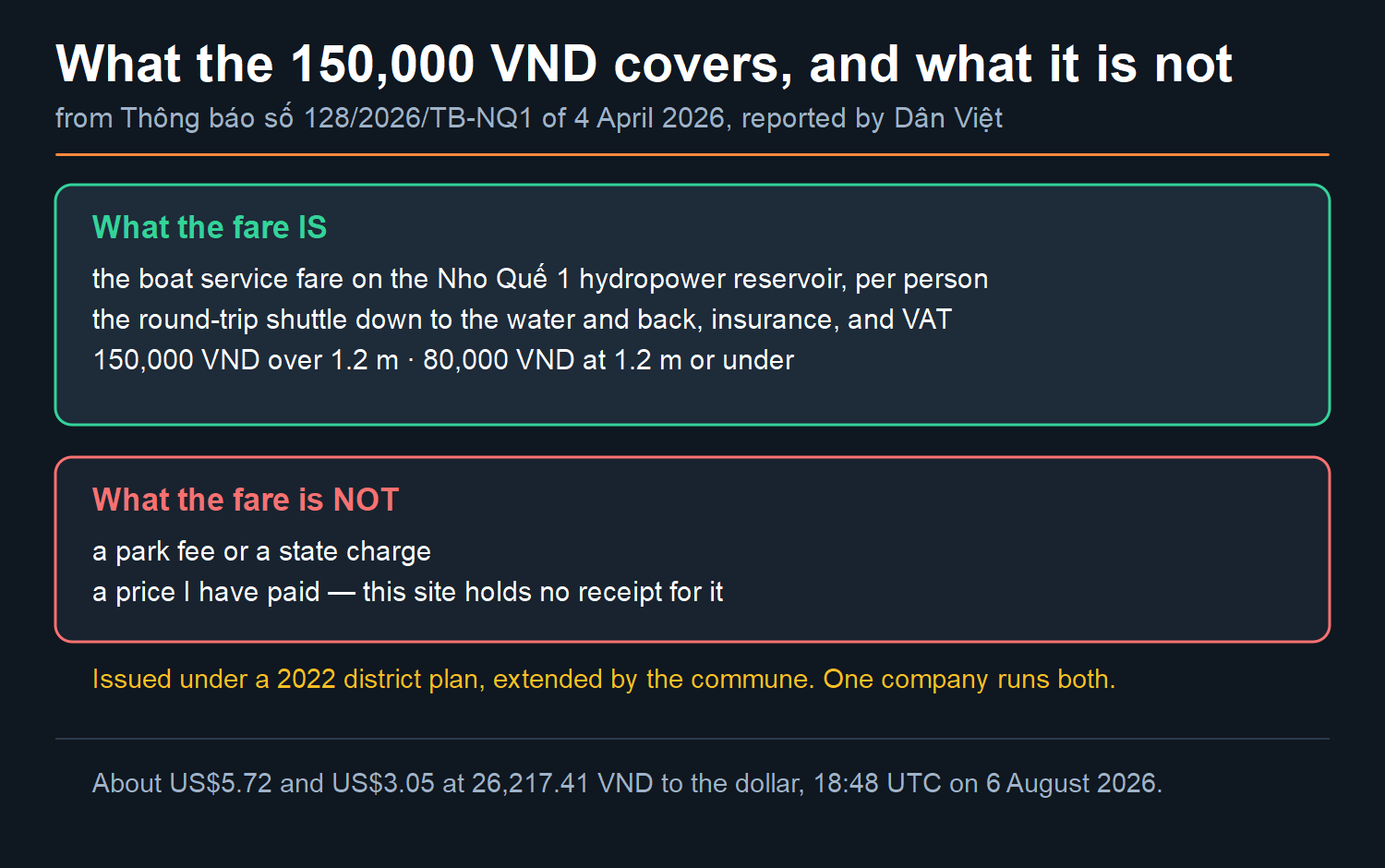
On 5 April 2026 the Vietnamese paper Dân Việt reported a new fare. Công ty Cổ phần Thủy điện Nho Quế 1 — the Nho Quế 1 hydropower joint stock company — had signed off a boat-service fare for the lake it operates.
The instrument is a notice, not a decision. It is Thông báo số 128/2026/TB-NQ1, dated 4 April 2026, and it rests on two earlier acts. Quyết định số 8280/QĐ-UBND of 28 October 2022, from the Mèo Vạc district People’s Committee, set the passenger-transport management plan for the reservoir. An official letter from the Mèo Vạc commune People’s Committee extended it.
That distinction matters more than it looks. A thông báo announces; a quyết định decides. The company announced a fare underneath a plan somebody else wrote.
The notice names the company’s director, Hoàng Văn Chiến. It takes effect 13 April 2026. The reasons given are a service upgrade and rising fuel and maintenance costs.
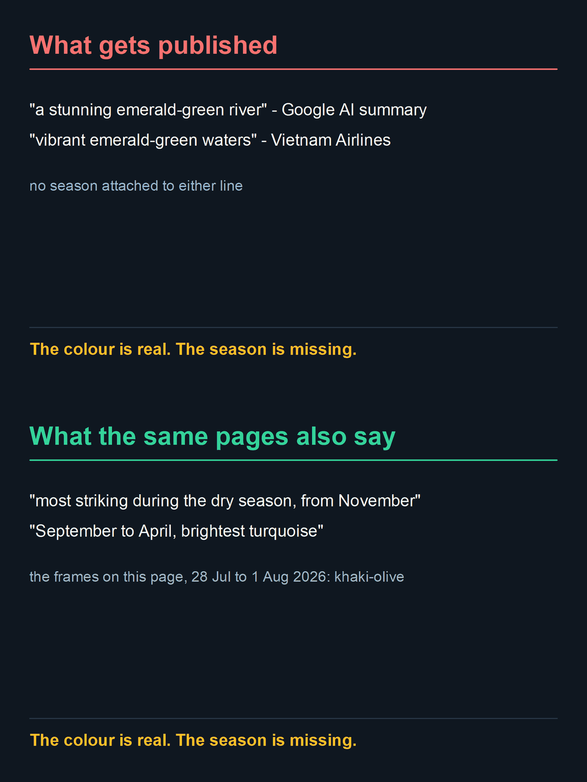
Compare that with what the English-language internet is telling you today. Google’s AI summary answers this question with “120,000 – 150,000 VND per person”. Vietnam Airlines’ own travel guide says “A 30-minute boat ride costs around 100,000 – 150,000 VND per person”. Neither carries a date and neither says who sets it.
A price range without a date is not information. It is a hedge. The useful version is: this is the number, this is who set it, this is the day it started, and here is the report I am reading it from.
Two honest limits on that. First, I am reading a newspaper’s report of the notice, not the notice itself — so treat it as a well-sourced figure, not a guarantee at the ticket window. Second, fares set by a company can move again the way this one just did. If you are reading this a season later, the mechanism on this page will still be right even if the number has moved.
You are not on a river. You are on a reservoir.
This is the part that reorganises everything else, and it is sitting in plain sight in the fare notice.
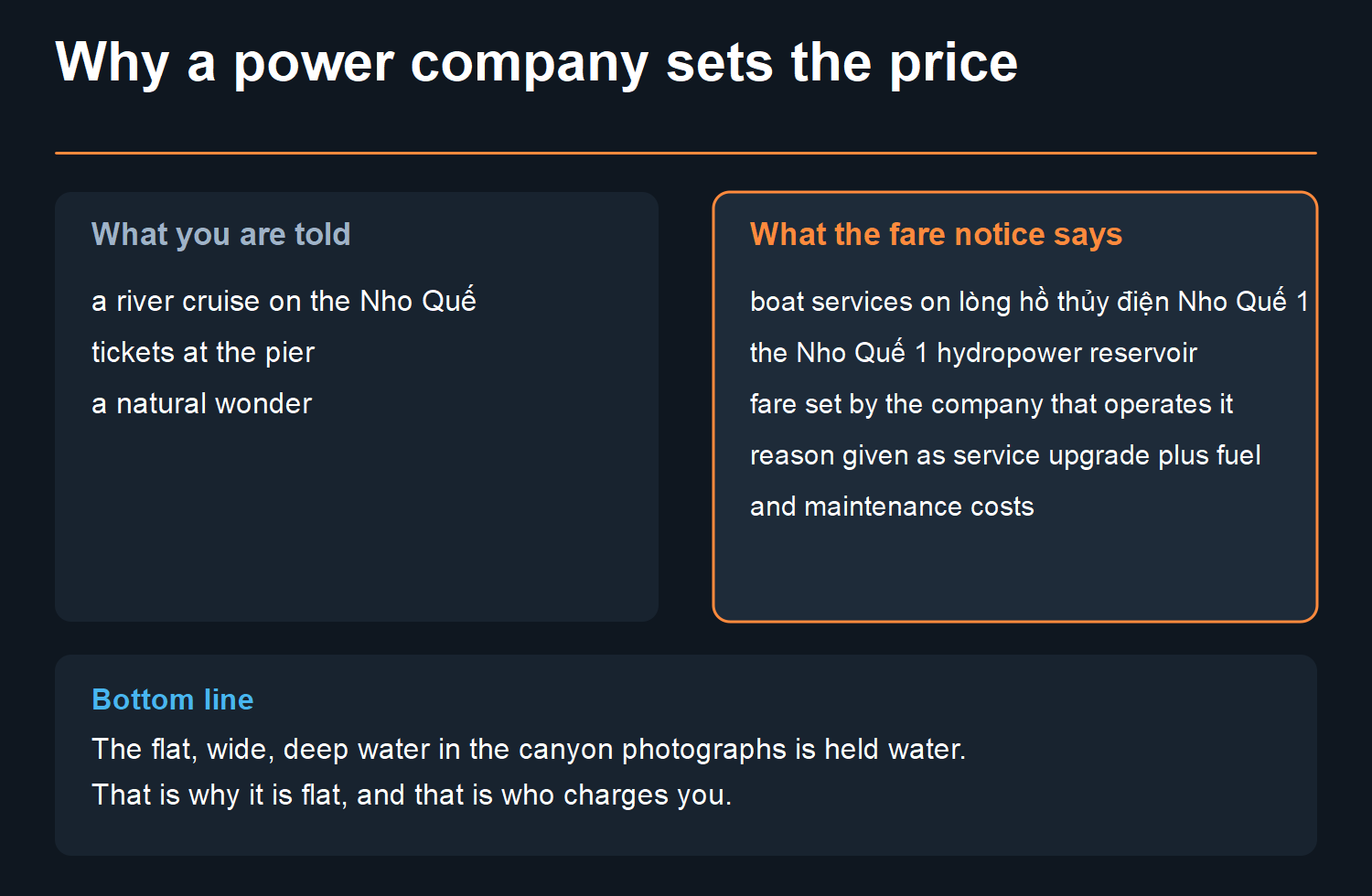
The document does not describe a river trip. It sets a fare for boat services on lòng hồ thủy điện Nho Quế 1 — the body of the Nho Quế 1 hydropower reservoir. The water the tourist boats work is impounded water, behind a dam, owned and operated as part of a power scheme.
Once you know that, two things stop being mysterious.
The first is why the surface is so still. A gorge river with that much fall behind it should be moving. This one reads like a lake in the photographs because on that stretch it is functioning as one.
The second is the fare itself. You are not paying a national park. You are paying a company that runs a power station and also runs boats on its own water. That is a perfectly ordinary arrangement, and it is also why the price can be changed by a signature in April.
Why isn’t the water green in my photos?
Because you probably came in the wet months, and the emerald is a dry-season colour.
The sources that sell you the emerald will tell you this themselves if you read past the first line. Vietnam Airlines’ guide leads with “vibrant emerald-green waters”, then concedes in its own body copy that the colour is “most striking during the dry season, from November, when the water remains clear and calm”. That is the only dated, publishable window I have for it — a named guide, quoted in its own words.
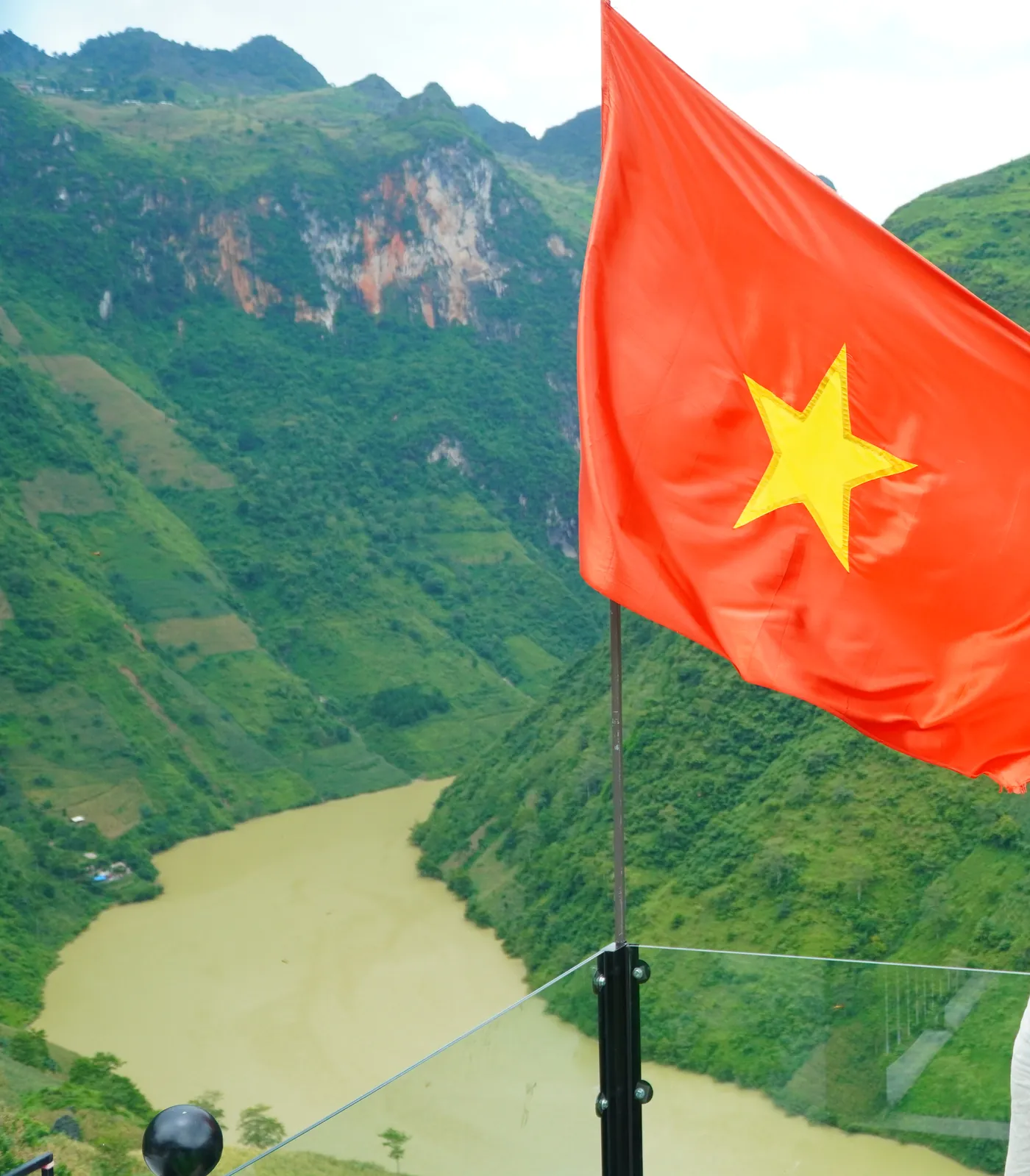
So the two claims are not in conflict. It is an emerald river — for part of the year. In the rain, the catchment above it moves a great deal of silt. What you get is the water in the photographs on this page: olive, khaki, tea-coloured. Still handsome in its way. Not the postcard.
If the colour is the reason you are going, that is a completely legitimate reason, and it should drive when you come rather than whether. The weather page has the months in proper detail, including what you give up in exchange for a dry sky.
How deep is Tu Sản, really?
Nobody knows, in the sense that matters. No official body has measured this gorge and certified a depth for it.
You will still find heights quoted for these cliffs, and they disagree with each other by hundreds of metres. Not one of them traces back to a named publisher I could check. So this page does not print them. I am not going to pick one, and I am not going to lay out a spread of numbers nobody has stood behind either.
The other thing that gets published is a phrase. “The deepest canyon in Southeast Asia” is attached to Tu Sản almost everywhere, and it is credited to Viet Nam’s National Authority of Tourism. I have not been able to confirm it at their own site. The page I was pointed to sits on vietnam-tourism.com, which refused the connection on 6 August 2026 — and that is not the Authority’s domain. Their own site is vietnam.travel, where the Tu Sản page returns a 404. I am reporting the attribution and declining to endorse it.
One more number, and this one is worth being fair about. Vietnam Airlines’ guide says the river is “situated at an altitude of over 1,500 meters”. That reads oddly next to a gorge you look down into — but the figure is not nonsense, and it is not wrong. It belongs to the river’s source, up in Yunnan, and Wikipedia puts that source at about the same height.
What keeps an altitude off this page is something else. The same guide has the river rising in Yunnan in one paragraph and in a village near Lũng Cú two paragraphs later. When a source contradicts itself on where a river starts, its altitude is not the number I would lean on.
Is it worth the morning?
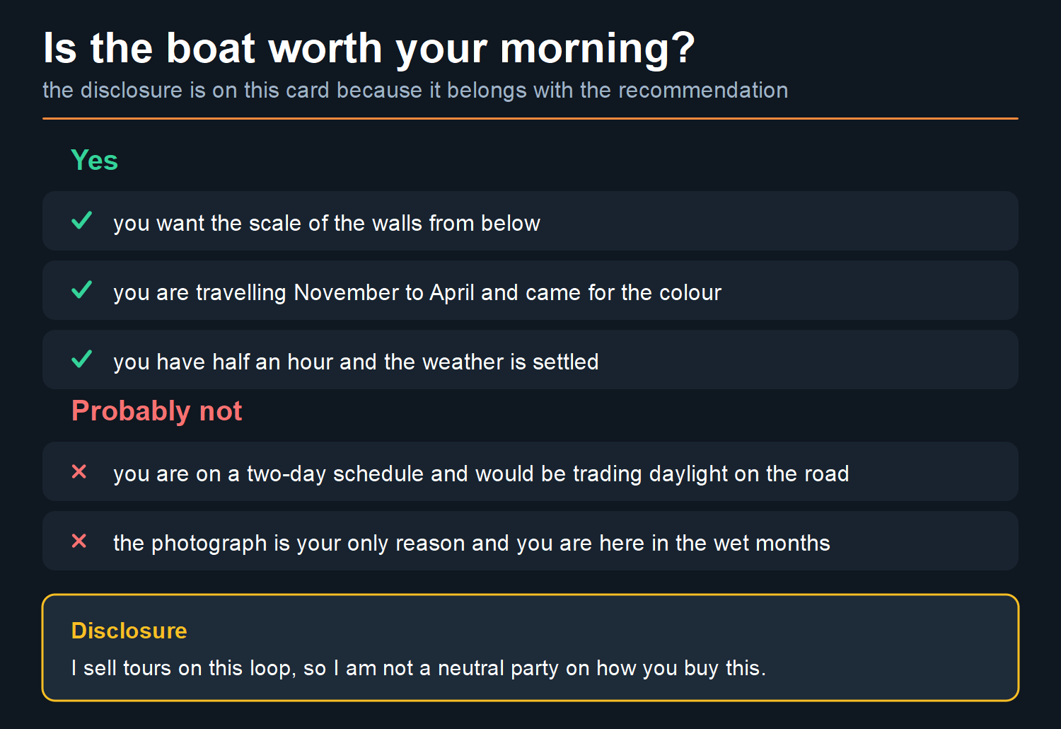
Before the recommendation: We sell tours on this loop. That makes me a competitor of every company whose package includes this boat, and it means I have a stake in how you book. So here is the disclosure first and the advice second, and you can weigh the second knowing the first.
For most people, yes — and for a specific reason that has nothing to do with the colour.
From the road above, you are looking down at the gorge. From the boat, you are looking up at it, and the walls do something to your sense of scale that a viewpoint cannot. Vietnam Airlines’ guide puts the ride at 30 minutes. That half hour is worth it in any season, at any water colour.
Two people I’d tell to skip it. Anyone on a tight two-day schedule, who’d be trading the boat for daylight on the road. And anyone whose whole reason for going is the photograph, in July, when it won’t be the photograph they want.
Included in your tour, or paid at the pier?
Both happen, and the answer changes what the boat costs you.
Some loop packages bundle it. Our own packages list “tickets for sightseeing and the Nho Quế riverboat” in the published inclusions — a page I read on 3 August 2026. That’s our own tour — Jasmine Tours is the company behind this site.
Others leave you to buy it yourself at the pier, which is where the 150,000₫ applies directly.
And that fare is not only the boat. The same Dân Việt report says the 150,000₫ covers chi phí xe trung chuyển hai chiều (cả đi và về), tiền bảo hiểm cho du khách và thuế Giá trị gia tăng (GTGT) — the round-trip shuttle down to the water and back, visitor insurance, and VAT.
The same company that issued the notice runs that shuttle: Công ty Cổ phần Thủy điện Nho Quế 1, the plant that owns the reservoir. So the boat, the transfer, the insurance and the tax are one commercial operation. Not a park fee, not a state charge, and not three separate things to budget for.
What I would actually do with that: ask, before you book, whether the boat is in the price. Not because bundling is a trick. Ask because two operators quoting the “same” price aren’t quoting the same thing if one includes this and the other doesn’t. What a package actually buys you goes through that comparison properly.
What the place is called now
The fare notice locates the reservoir in xã Mèo Vạc, tỉnh Tuyên Quang.
If that reads wrong to you, it is because almost every English-language page still says “Mèo Vạc district, Hà Giang province”. The notice files the lake under xã Mèo Vạc, tỉnh Tuyên Quang, because the province and the district tier it used to name both went in the 2025 reform. Mèo Vạc is now a commune reporting to Tuyên Quang.
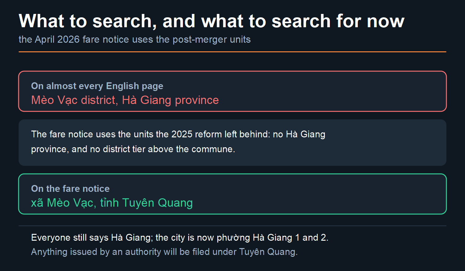
The place has not moved and the name Hà Giang has not disappeared — everyone still calls the place and the loop Hà Giang. But the city is no longer an administrative unit either: under Nghị quyết 1684/NQ-UBTVQH15 of 16 June 2025, the old city’s wards became phường Hà Giang 1 and phường Hà Giang 2. Official documents, newer signage and anything issued by an authority will use the new units, and the fare notice is a good example of exactly that. The page on what Hà Giang is and what it is called now has the instrument, the dates and the numbers.
Practical version: search in both. If you are looking for anything official about this stretch of water — a fare, a closure, a safety notice — you will find it filed under Tuyên Quang, not Hà Giang.
Common questions
How much is the Nho Quế boat trip?
150,000₫ per person over 1.2 m tall, 80,000₫ at 1.2 m or under — roughly US$5.72 and US$3.05 at 26,217.41₫ to the dollar, 18:48 UTC on 6 August 2026. That fare was set by Công ty Cổ phần Thủy điện Nho Quế 1 and took effect on 13 April 2026, as reported by Dân Việt on 5 April 2026. It is not a price I have paid, and this site holds no receipt for it — it is the fee-setting company’s published notice, Thông báo số 128/2026/TB-NQ1, as reported by a newspaper.
Is the Nho Quế really emerald green?
In the dry months. Vietnam Airlines’ guide says the colour is “most striking during the dry season, from November”. In the wet season the water carries silt and runs khaki — which is what the photographs on this page, shot between 28 July and 1 August 2026, show.
Do I need to book the boat in advance?
I have no sourced answer to that and I am not going to guess one. Ask your operator, or ask at the pier. If the boat is bundled into your package, that’s already settled for you. And remember: We sell tours on this loop, so on the bundled-versus-separate question I’m not a neutral party.
How deep is Tu Sản canyon?
No official body has measured this gorge and certified a depth for it. The heights you will find published disagree with each other by hundreds of metres, and none of them traces back to a named publisher — so this page does not print them. The “deepest canyon in Southeast Asia” phrasing is credited to Viet Nam’s National Authority of Tourism; I could not confirm it at their own site, vietnam.travel, on 6 August 2026, so I report the attribution without endorsing it.
Is it a river or a lake?
Both, depending where you stand. The Nho Quế is a real river, a tributary of the Gâm, running about 192 km with roughly 46 km in Vietnam. The stretch the tourist boats work is the Nho Quế 1 hydropower reservoir, which is why a power company sets the fare and why the water is so flat.
Where is it, officially?
Xã Mèo Vạc, tỉnh Tuyên Quang, as of the April 2026 fare notice. Older pages say Mèo Vạc district, Hà Giang province — both the district tier and the province were changed by the 1 July 2025 reform.
Where the numbers on this page come from. The fare, the height threshold, the effective date and the company name are from Dân Việt’s report of 5 April 2026, accessed 6 August 2026. The river’s length and the seasonal colour caveat are from Vietnam Airlines’ own travel guide, accessed the same day. The watercourse and the Gâm tributary relationship are from the Wikipedia entry behind Google’s knowledge panel. The dollar figures convert at XE’s mid-market rate of 26,217.41₫, 18:48 UTC, 6 August 2026.
What is not here: a price I have paid, a canyon depth stated as fact, and an altitude. We sell tours on this loop, and we have no first-party record of this fare. A page that pretended otherwise would be worth less to you than one that says so.
Photographs taken between 27 July and 3 August 2026. Diagrams and cards on this page are mine.